
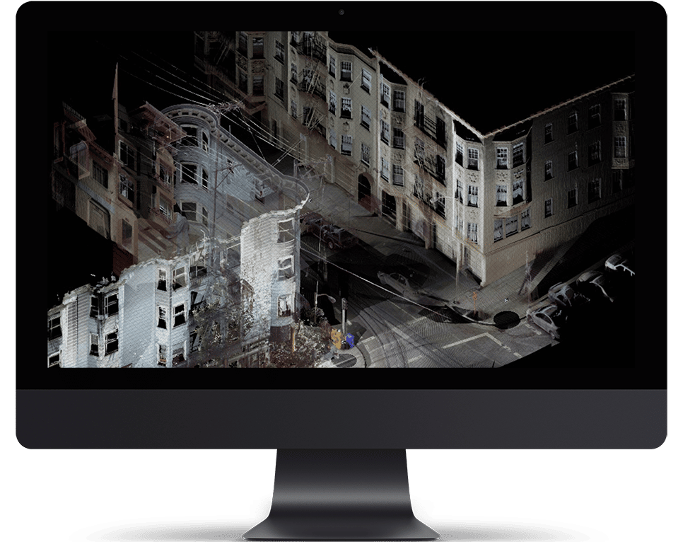
Infrastructure
Infrastructure
Unmanned Aerial Systems have proved to be a great inspections tool for infrastructure assets and urban planning. It allows quicker mobility while increasing safety and efficiency. From under deck bridge inspections, to traffic monitoring, we are able to provide a wide array of services using our industrial drones along with powerful AI integrated software.
Drone Efficiency
Asset Management Software
Using our asset management software on the cloud we can offer clients remote access to inspection data. Our software helps support Asset Management decisions. The Airscope software allows you to:
• Playback data on the cloud
• Make notes on analysis
• Compare with previous reports
Technology
SOFTWARE
Better Analysis using the latest industry grade UAS software.
Automated Flights
By programming automate an entire drone flight - including drone and camera movements, we are able to fly precisely the same flight over and over again.
Cloud Storage
We can grant clients cloud storage to view data collected using our drones remotely at any point of time. This is essential in the event of large data storage.
Playback Content
Data such can be played remotely in real time by inspectors and can also be replayed multiple times. Clients can also make observatory notes in the playback cloud.
TECHNOLOGY
Better Analysis using the latest industry grade UAS technology.
GPS Enabled
Onboard GPS modules ensure that our aircraft hold accurate positions in outdoor environments. GPS also assists in automated recovery in case of an emergency.
Obstacle Avoidance
Position sensors installed onboard help the aircraft avoid obstacles as well as provide for an additional level of safety during indoor flights and areas of low GPS connectivity.
Industry Grade
Industrial environments require high endurance systems that can perform in harsh conditions including high temperatures, areas of abnormal magnetic fields etc.


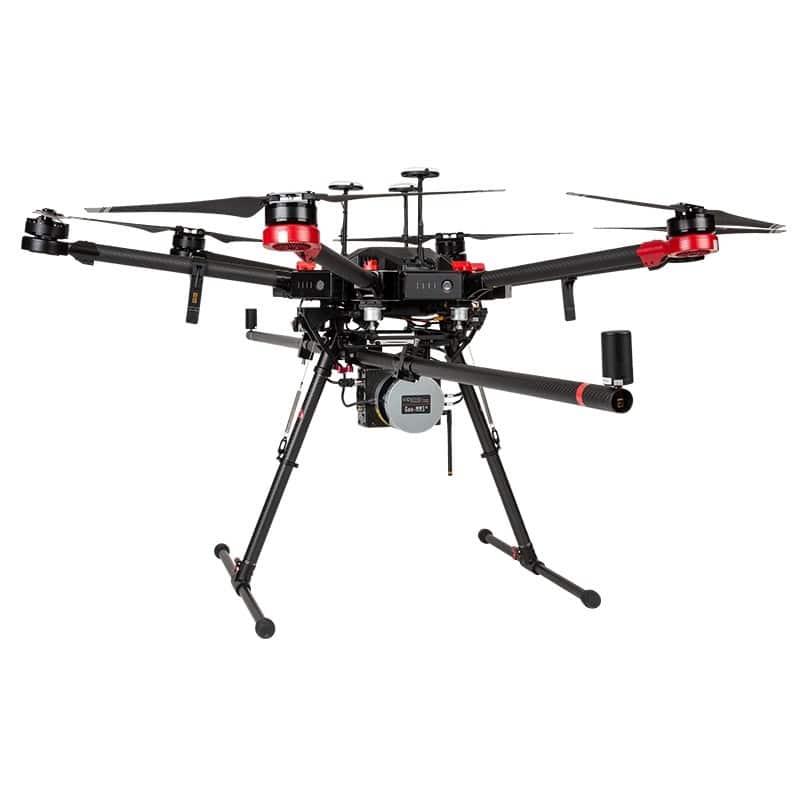
Multiple Sensors
Our aircraft are able to carry multiple sensors. For inspection purposes we primarily use a combination of an optical zoom camera along with a thermal camera to collect valuable data.
Live Broadcast
We have industry grade technology that allows for long range live broadcasting in fullHD in the event of remote inspections.
Weather Proof
To provide robust industry grade services we work hard towards providing solutions that work seamlessly in harsh weather conditions.
Company
Safe
Safety is our primary concern, due to which we make sure, that our team is highly qualified and always perform risk mitigation prior to any project.
Certified
Certified internationally by the FAA as well as all local civil aviation authorities in the United Arab Emirates, we ensure that all aspects of legality are covered.
Insured
Thanks to our 0% accident track record, all our aircrafts have liability insurance of up to $1,000,000 in third party coverage in case of an unforeseeable event or natural disaster.
Being one of the first Unmanned Aerial Services providers in the middle east, we have pioneered the integration of drone technology to help increase efficiency while reducing risks across various industry verticals, from construction to law and enforcement. We are both, a services provider of drone services such as remote inspections and survey as well as a solutions provider of customised systems such as drone delivery mechanism.
Our vision is to be market leader in the Unmanned Systems technology and services business by providing bespoke solutions.
Airscope’s mission is to continuously integrate Unmanned technology and AI (Artificial Intelligence) across industries, to increase safety and efficiency.


INDUSTRIAL SERVICES
Inspections
Survey
Thermography
Tethered Drone Solutions
Multi Spectral Imaging
Reality Modelling
Consulting
R&D
Reporting
Geospatial
Panoramic Photography
Drone Permits
Drone Training
INDUSTRIAL SECTORS
Oil & Gas
Flare Stack Inspection
Pipeline Inspection
Tank Inspection
UnderDeck Inspection
Structural Inspections
VOC Monitoring
Utilities & Renewable Energy
Transmission Line Inspection
Solar Inspection
Wind Turbine Inspection
Com. Tower Inspection
..
Infrastructure
Rail Inspection
Bridge Inspection
Dam Inspection
Road Inspection
Traffic Analysis
Civil Construction
Stockpile Analysis
Build Monitoring
Onsite Asset Monitoring
3D Modelling
..
Emergency Response
Incident Management
Post Forensic Analysis
Search and Rescue
Intelligence Gathering
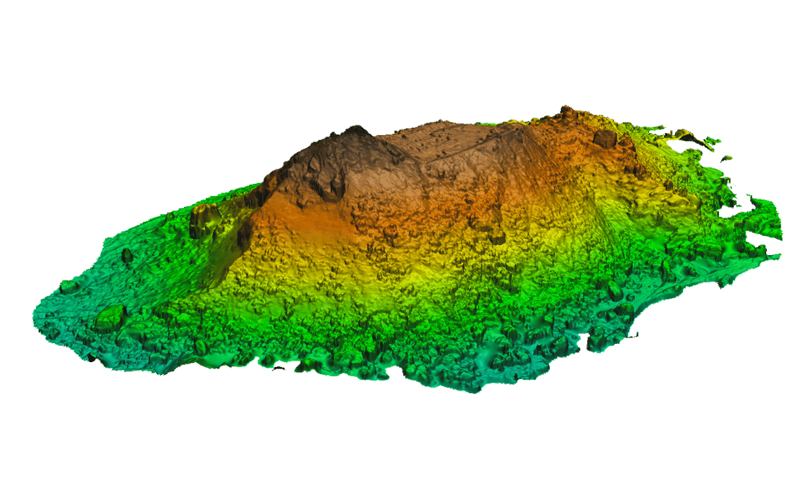
Mining
Stockpile Analysis
Terrain Modelling
Elevation Modelling
..
Waste Management
Agriculture
Real Estate
Security
Intelligence Gathering
Perimeter Patrol
Prevention
Asset Security
Mobile Command
Drone Defence
CREATIVE SERVICES
FAQ's
Frequently Asked Questions
As a registered Drone Operator, Airscope is licensed by the all civil aviation authorities across the United Arab Emirates, to apply for all necessary permits on behalf of our clients. Please contact us to find out costs and requirements. Our Drone Permit Handling Service is designed to assist our clients in getting the needed permits as quickly and easily as possible!
We offer a range of drone services, with a number of different drones to meet our client’s requirements, and budget. Please contact us to discuss your requirements, and we will be happy to draw up a detailed proposal including all operating costs & permit fees.
Permit costs vary by location. Please contact us to get a complete breakdown of permit costs for your requirements.
Under Civil Aviation regulations we are allowed to fly a drone to a height of 400ft (120m), and to a distance of 500m. If your project requires us to fly higher or further than this, we will have to present a suitable Risk Assessment to Civil Aviation in order to request an exemption. Please contact us for more information.
Under Civil Aviation regulations we are not permitted to fly a drone above people or vehicles that are not under our control. If your project requires us to do so, we will have to present a suitable Risk Assessment to Civil Aviation in order to request an exemption. Please contact us for more information.
We offer complete drone solutions to various industries, building customized drones to meet our client’s requirements. Please contact us to discuss your requirements.
It is illegal to fly a drone for commercial use without a permit anywhere in the UAE. If you would like to fly a drone for personal use, it is a legal requirement in Dubai that you obtain a hobby license. Through our close relationship with SANAD Academy, the region’s first Civil Aviation certified drone training academy, you can obtain a license to fly a drone for personal use for just AED 500. The instructor will teach you how to fly safely and show you where you are allowed to fly.
Airscope offers specialist training as part of our industry consulting services. Please contact us if you would like help to set up a drone department in your own company. If you wish to learn how to fly as a hobbyist, we recommend you contact SANAD Academy.
Automated Timelapse
Computer Assisted Filming & Photography
By programming automate an entire drone flight – including drone and camera movements, we are able to fly precisely the same flight over and over again. The resulting video and photographs allow for immediate and apparent evidence of construction progress on a weekly or monthly basis.
Specifications
• 4K UHD Video Filming
• 24 Megapixel Photography
• Computer controlled Drone & Camera movements
• Repeatable & identical each time
Outcome
At the end of a project, a final film that shows the progress of construction over time can be edited. Using sophisticated motion graphics, we can “paint in” the construction progress in a compelling exploration of the progress and stages of construction, providing a lasting and powerful visual summary of the development of a project that your clients and stakeholders will refer to for years to come.
Survey

Site Monitoring and Progress Reporting
a. Ultra-High Resolution
b. Next day results that are immediately actionable
c. Online shareable maps with built in measurement tools
d. Overlay and compare and weekly or monthly surveys
e. High accuracy – can be combined with optional Ground Control Points (GCP’s) to increase survey accuracy to < 3cm
Instant Information & Decision Making
Digital Surface Models
a. Ultra-High Resolution
b. Topographical Mapping
c. Accurate volumetric measurements for earthworks & stockpile management
3D Models
Highly detailed models for Presentations & Visualization

Construction Overview
Airscope - The Leading Provider of Hi-Tech Drones for Construction Sites
Overview
Airscope has built an excellent reputation for successfully providing high quality drones for construction in the UAE and globally ever since its inception. Our cutting-edge drones provide 3D mapping technology and aerial and visual and thermal sensors for high resolution imaging.
Drones in construction provide stakeholders with progress reporting during pre-construction and throughout the project lifecycle, and have been shown to increase efficiency through effective oversight of material management, housekeeping, and dispute resoltion.
In addition to our aerial visual inspection services, Airscope offers additional services to the construction industry, including our online survey data platform, which allows for rapid decision making based on up to date survey grade data.
Site Monitoring and Progress Reporting Through the Use Drones in Construction Projects
Our user-friendly online platform makes it possible for companies to improve their workflows through rapid data processing and real-time sharable drone maps and 3D models with built in measurement and analysis tools.
Our accurate & rapid drone surveys combined with our online data sharing platform allows for project monitoring with built in measurement & analysis tools and data sharing.
Save Time, Money and Manpower On Your Construction Sites
We provide detailed analytical reports through drone surveys using powerful data processing software to construction companies for the improvement of their workflows. With our high-quality drone images and survey data of your construction site, you will be able to investigate and inspect your project for any kinds of faults, damages or problems with less downtime, and quickly identify deviations and minimize costly and timely reworks. Moreover, you will be able to manage your resources and risks better, which will save both your time and costs on unforeseen incidents.
Most importantly, we are certified with all local civil aviation authorities in the UAE. We boast of a 0% accident track record, and perform detailed risk mitigation prior to initiating work on a project.
Contact Us Today
Find more information about our services by getting in touch with us at +971 (0)526973968 or send us an email at info@airscope.tech